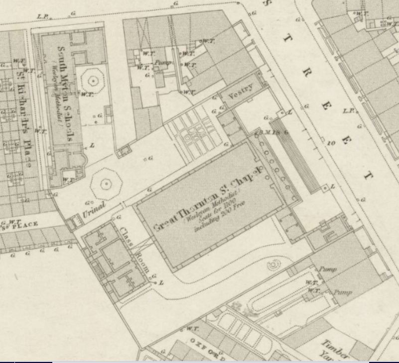
Great Thornton Street Wesleyan Methodist Chapel was the most imposing Methodist building in Hull. It was built in 1842 and in 1851 it provided 300 free and 1000 other sittings. The ground plan made two years later shows that the chapel was built on a platform reached by a short but wide flight of steps. The front portico was supported by eight columns and the chapel was seven bays in length. At the front, short wings extended from the sides of the chapel to terminate in small buildings, one of which was used as a vestry. On each side of the chapel there were open spaces and a classroom block stood at the rear of the site. Extending from the northwest corner of the chapel site were the South Myton Wesleyan Schools. Their block appears to contain a master’s house, two large and three small rooms. The plan of the chapel had hardly changed by 1888 but the former vestry had become a class room and the structure had undergone some modifications designed by T B Thompson and its name had been to Thornton Hall. This building was replaced by a new Thornton Hall seating 1900 in 1908
Sources
The Yorkshire Returns of the 1851 Census of Religious Worship, ed. John Woolfe, Vol 1 City of York and the East Riding No. 438
Ordnance Survey 1:1056 plan of Hull, 1853, sheet 11 reproduced with the permission of the National Library of Scotland (Map images website)
Ordnance Survey 1:500 plan of Hull, 1888-9, sheet CCXL 2.25 reproduced with the permission of the National Library of Scotland (Map images website)
Pevsner, N Yorkshire: York and the East Riding, p. 287
John Rylands Library University of Manchester Returns of Accommodation provided by Wesleyan Methodist Chapels and other Preaching Places, 1931 Hull Mission Circuit, DDPD2/4/633


No Comments
Add a comment about this page